All but the hardiest and most devoted of minimum boaters will have some form of chartplotter aboard and Orca is certainly a game changer in the field

This article in association with Orca:
Digital navigation is slowly replacing traditional chart-table work for most cruising sailors, even though many still carry aging paper charts. We’ve become used to those large, boxy plotters (or multifunction displays, as some would call them) with their heavy demand on the batteries and on our wallets.
It is genuinely exciting to see a disrupter entering the digital navigation space with a product that looks and feels rather different. Orca straddles the distinction between hardware and software with a range of products designed to deliver a far more intuitive navigation experience than the “big three” instrument manufacturers. What’s more, they hit a much lower price point as well.
Modular system
Orca comprises a free app that anyone can download and run on their smartphone or tablet, a clever box of tricks called the Core 2 and a robust marinised tablet known as the Display 2. At its most basic, the app delivers beautiful, fluid charts developed by the Orca team from hydrographic data (they count a former C-Map developer amongst their number). The chart engine was built from the ground up and includes all the key data you’d expect about marks, depths and charted objects.
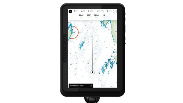
Using phone/tablet GPS the app can plot your position and calculate course and speed. It will also display internet AIS data and plot other vessels showing their course and speed. And it boasts one of the most powerful course planning tools out there, able to quickly plot the fastest route from A to B. So far, there is no cost to the user.
But Orca is capable of much more than this. Buy an Orca Core for £499 and install it in your instrument network and the possibilities multiply. Now you can receive, display and log real instrument data wirelessly on your Orca app: wind speed, depth, boat speed and so on. And if you have an AIS receiver/transceiver, it will display that data too.
Radar and autopilot
Crucially, the Core also supports common radar and autopilot units from manufacturers including Raymarine, Simrad, B&G and Lowrance. It can receive radar images and control units via an ethernet socket or wirelessly. This turns your phone or tablet into an instrument that can steer the boat, set courses and manipulate the radar.
It is simple to integrate the Core into your existing network because it uses the same NMEA 2000 protocol that lies behind most instruments installed since 2010, and can simply be plugged into the backbone. If you have an older NMEA 01832 network then you’ll just need an additional converter to attach the Core to the system.
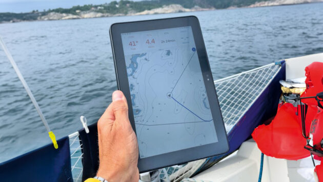
Take your plotter with you
Why is all this big news for the cruising sailor? Well, it puts your chartplotter in your pocket, on the foredeck, at the helm – wherever you want, in fact. Some sailors will dedicate the Orca app on their phone to the autopilot and mount their tablet near the helm for navigation. Others relish the ability to take their Orca plotter home with them and plan out voyages from the comfort of an armchair. Routes, waypoints and charts are all there.
For the very best experience, it’s worth paying an additional £44.99 annual subscription to enable Orca Plus. This gives access to charts offline and enables automatic routing tailored to the weather conditions and your boat’s polars. You can also get recommendations on when to leave, based on weather, tides and the optimum route. Hi-res satellite overlays are also added to the toolkit.
It all comes in at far below the cost of buying and fitting a new chartplotter. Even if you decide you want the dedicated Display 2, which features a beefed-up battery, wide viewing angles and daylight readability, the £899 cost is lower than a comparable 10in chartplotter. Plus, it can be used to run any other Android apps you care to download.