
Solo sailor Owen Moorhouse, now 97 and still living aboard, recalls how catching a warning on the radio allowed him to get to safety with just hours to spare.
Solo sailor owen Moorhouse built his first 11ft Vee Jay as a teenager and has enjoyed a lifetime of yacht ownership. At 97, he lives aboard Sandpiper, a 38ft Roberts sloop which he maintains himself. As a youth, he canoed wild rivers in Australia and New Zealand in self-built craft and he has sailed much of the east coast of Australia, often single-handed.
Crowdy Head is an artificial boat harbour on the north coast of New South Wales.
It was built in the 1960s and designed to provide a haven for a small fishing fleet and is now also home to a permanent Volunteer Marine Rescue vessel.
The harbour’s relentless swell makes it uncomfortable for cruising yachts and at best it’s an overnight stay. I stopped there on arrival from Port Macquarie, 26 miles further north, but was glad to set sail the next morning on my journey south.
My plan was to pick up a mooring buoy at Broughton Island, an uninhabited island about 55 miles south of Crowdy Head, named after Commander William Broughton who surveyed the area in 1795. If I made better time than expected, I’d head for Port Stephens which is a safe, snug place to berth.
However, given that’s some 10 miles further south, it makes for a rather long sail, especially for a solo sailor like me. My destination was Pittwater (north of Sydney Harbour), which is another very full day’s sail further south.
Port Stephens and Newcastle are the only all-weather ports between Crowdy Head and Pittwater. Cape Hawke is another marginal possibility although one I’d rather enter in near perfect conditions and only on a making tide.
Navigational hazards
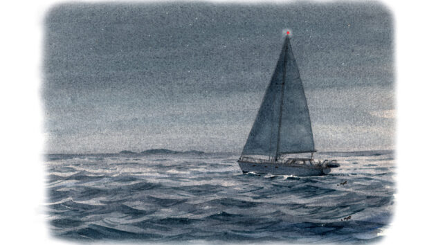
The passage from Crowdy Head south to Sugarloaf Point was most enjoyable as an offshore westerly provided a smooth sea reach. The welcoming light on Sugarloaf Point became visible just as darkness fell, signalling that I was about 15 miles off Broughton Island.
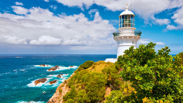
Sugarloaf Point Lighthouse at Seal Rocks, New South Wales. Photo: Ingo Oeland / Alamy.
Sugarloaf Point is more popularly known as Seal Rocks, for Australian fur seals are sighted here on occasion. However, sailors know the area more for the number of unlit rock hazards that extend a couple of miles to sea.
Some are clearly visible, while others are awash at high tide, but all are within the light’s red sector. This gave me plenty of time to make a wide berth and set a south-westerly course for Broughton Island, all the while still hoping to reach Port Stephens.
As evening approached the offshore breeze slowly died and was eventually replaced by an onshore wind, as is normal for the southern coastal waters of New South Wales.
I required the assistance of my trusty Vetus engine, until a steady breeze helped maintain my southward progress.
I reassured myself that it was too early in the season for the annual migration of whales, even though I’d encountered a magnificent one on a previous passage. It had broached immediately ahead of me, requiring some urgent action to avoid the colossal mammal. It seems that Broughton Island and Sugarloaf Point are favourite landfalls for whales on their long migratory route north from the waters of the Antarctic.
‘Sécurité’ Warning on Ch16
I sailed on into the darkness. Suddenly at around 0200 EST, my VHF Ch16 boomed ‘Sécurité, sécurité, sécurité! All ships. All ships!’
If I had been dozing off, I certainly wasn’t now!
It was harbour control from Port of Newcastle ordering all shipping at anchor in Stockton Bight to proceed seaward ahead of foul weather.
Newcastle may be the largest coal loading port in the world, handling some 4,500 ships a year, but the harbour there is not large. This means all ships must anchor outside the harbour and await their designated turn to load.
In bad weather, anchored bulk carriers remain exposed to the lee-shore and anchor-drag is always a risk. It’s not unusual for ships in the vicinity to be advised to start their engines and lift anchor to avoid grounding on the long beach that skirts Stockton Bight. In my memory, at least two ships met with this fate, including the Pasha Bulker (2007) and MV Sygna (1974,) plus more than 30 others dating back to the 18th century.
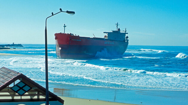
The Pasha Bulker bulk carrier ship, ran aground on Nobbys Beach in Newcastle, New South Wales, Australia on 18 June 2007. photo: Russotwins / Alamy.
The storms originate in the south and their ferocity can be gauged by the fact that the Sygna was driven ashore by a 17m swell where it broke in two. The rusting hulk is a permanent feature on the beach. The Pasha Bulker was eventually salvaged and towed to Singapore for repairs.
Resisting temptation
By this point, Port Stephens light on Fingal Island was clearly visible, confirming I was seaward of Broughton Island and about half-way to an anchorage off Providence Beach on the northern side. Emerald Cove on the south-east side of the island, appears idyllic but it lay directly in the path of the approaching storm that was now expected within hours.
I debated my best course of action. Should I continue to the anchorage at Broughton Island or turn back and seek shelter in Sugarloaf Bay? Both locations were about equidistant.
To anchor off an uninhabited island with poor to no radio reception was one risk, but I knew the approaching southerly low-pressure cell would eventually produce easterly winds and, as the storm progressed further to the north, the situation was sure to become more complicated.
I hastily reviewed my options. If I headed back about four miles the same weather conditions would eventually affect Sugarloaf Bay, but considering the benefit of radio contact and onshore services I quickly brought Sandpiper around and headed back north.
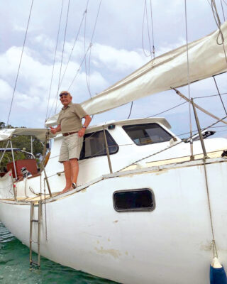
Solo sailor Owen’s near-miss aboard Sandpiper happened in 2015 when he was 87. Photo: Owen Moorhouse.
Seeking shelter
Sugarloaf light stands 78m at 32°26’S, 152°32’E and displays a red sector from 307° to 010°N, covering a nasty litter of visible and submerged rocks that extend approximately two miles south-east.
Naturally, I laid a course to give them plenty of clearance before proceeding westward once I was convinced I was well north of the rocks. From the map, I’d selected a possible anchorage under Statis Rock at the eastern entrance of Sugarloaf Bay.
It had mast-high protection and provided shelter from both the south and the east. By the time I was under Statis Rock daylight was already breaking and having sailed through the night, I was feeling rather weary.
With a manual winch I attempted to set the anchor but a sandy bottom over a rock shelf offered no confident holding. Perhaps I should have recalled that local fishermen often beached their boats here, undoubtedly aware of similar difficulties.
I further assessed my options, but heading back to Broughton Island was not one of them. That left only Cape Hawke Harbour, 17 miles back up north. By now, I was approaching 24 hours of continuous single-handed sailing. I had eaten little and was fatigued.
Yet I knew from experience that east-coast lows can be brutal, leaving me with no option but to sail back north from where I’d come. There, on a making neap tide, I could enter Cape Hawke Harbour which I knew to be secure.
Pit stop
Fortunately, I had the wind on my starboard quarter and my Sailing Directions made mention of Charlotte Head, half way to Cape Hawke. It appeared to offer protection from all but north-west weather and, if acceptable, it would allow me time to cook a meal and get some rest while I waited for the tide to turn. From Charlotte Head, it would only then be a 10-mile sail north-west, to the safety of Cape Hawke harbour, named in 1770 by Captain Cook, as he sailed past in the Endeavour.
Fatigue started to cloud my reasoning but to my delight Charlotte Head and Shelley Beach soon provided me with a temporary refuge, while a hot meal and a power nap improved my demeanour immeasurably. Radio contact with Forster-Tuncurry VRM confirmed the tide to be high at 1700 and the bar was no real cause for concern.

Shelley Beach, Port Macquarie, New South Wales. Robert Wyatt / Alamy.
Allowing myself three hours sail time, I approached Cape Hawke and proceeded north to Forster-Tuncurry breakwater. With surf to starboard I aligned Sandpiper and motored south-west for about 200m between the break walls, before making a sharp starboard turn to avoid the sandbar which was dead ahead.
With the sandbar then to port, I skirted through the narrow channel until I’d passed the local fishing co-operative.
I planned to moor alongside one of the many abandoned trawler wharves, each encrusted with the famous Wallis Lake oysters which, although delicious, are extremely abrasive to any hull.
A low-level road bridge further upstream presented itself as another potential calamity. As the tide was still running, I headed briskly into the tide to come alongside the wharf. I quickly positioned my fenders and a chaffing board to protect against the oysters, before making a sharp 180° turn to avoid running aground on the sandbank, just 50m to port.
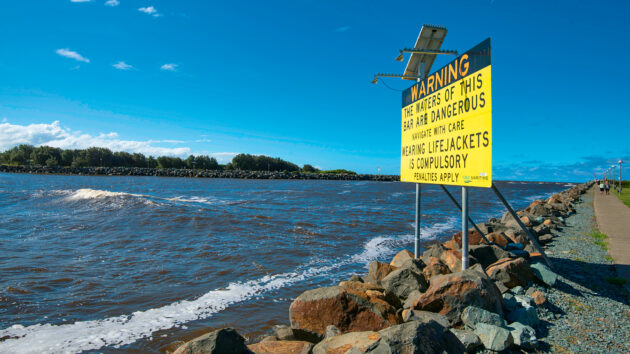
A warning sign to mariners and boating enthusiasts at the breakwater at Forster Tuncurry. Photo: Stephen Dwyer / Alamy.
Welcome assistance for a solo sailor
A gentleman on the wharf realised my predicament and quickly signalled that he’d take my bow line.
I inched into the incoming tide before running forward to throw him the mooring line. To my horror, it fell short!
A repeat manoeuvre finally put the line in his reassuring hands, and he secured it to a bollard, allowing me to swing Sandpiper alongside the wharf and complete the mooring.
To have said I was totally exhausted would have been an understatement. I’d been sailing for 33 hours, in a completely circuitous route. There’s no rest for a solo sailor!
Safe inside the harbour, I awaited the arrival of the promised southerly blow. It hit six hours later and, even in port, I felt its ferocity. I curled up in my bunk. As the winds howled, I thought about the course of events, my head spinning with exhaustion.
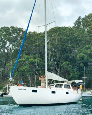
Sandpiper, a 38ft Roberts sloop has been on many adventures with solo sailor Owen Moorhouse. He still lives aboard aged 97. Owen Moorhouse.
Lessons learned for a solo sailor
Had I simply tuned into the routine coastal forecast, I may not have heard the warning for another 4-5 hours, by which time it would have been too late to head for cover.
Had I not reacted to the warning for all vessels to proceed to sea (or in my case to seek shelter) the consequences could have been catastrophic.
As I drifted off to sleep I reminded myself how important it is to make timely, critical assessments when confronted with such conditions, and for a solo sailor like me to be aware of his limits.
Hearing those words, ‘Sécurité, sécurité, sécurité! All ships! All ships!’, literally saved me.
The takeaway?
-
- Be sure to maintain continuous VHF Ch16 radio watch.
- Have a back-up plan for an alternative anchorage, in case of emergency.
- Have a copy of Sailing Instructions for your voyage, as sometimes the overnight shore radio is unfamiliar with port entry details.
- Be aware of your physical limitations and act accordingly.
Expert response from Heidi Clevett, head of technical infrastructure at HM Coastguard
As Owen details in this article and experiences first-hand at sea, Ch16 is the International Maritime VHF Channel used for distress, urgency, safety working and voice calling (156.800MHz). Most importantly, Ch16 is not a radio check channel and should not be used for routine communications.
Boaters and water users with access to VHF radios should keep a listening watch on the channel to be aware of any potential distress calls, developing situations, or incidents nearby. Mayday calls, which should only be used in serious emergencies and life-threatening situations, provoke an immediate response from the Coastguard and other vessels within range. The range of VHF is usable line of sight transmitter antenna to receiving antenna, so a higher ship antenna, say 50m, typically gives greater range, sometimes 50-plus miles.
Ch16 can be used for Pan-Pan alerts too, which indicate a vessel declaring an urgent situation that is not an immediate threat to vessel or passengers, such as a mechanical issue, a loss of navigational equipment, or a non-life-threatening emergency. Both Mayday and Pan-Pan calls have priority over all other transmissions and should communicate your vessel’s name/ identity, position, nature of problem, assistance required and number of persons on board.
Most modern radios will also include a Digital Selective Calling (DSC) button that, when set up correctly, will automatically broadcast your vessel’s MMSI and GPS location over multiple frequencies. DSC uses a registered MMSI and a wired link between your radio and GPS. This must be set up correctly to work.
A broadcast on Ch16 could be the most important call you make during an emergency, so it’s worth practising your vessel’s key details to commit them to memory. Also, consider having a logbook to hand to note down any distress calls received, and the key information shared, plus the details of your vessel, passengers, and location.

How to sleep sailing shorthanded
John Apps stresses the importance of sleeping sufficiently on long-distance single-handed passages, and explains how to snatch safe naps without…
22 practical tips for a single handed sailor to make your boat easier to sail
Doctor Tom Miller shares some ideas to help make single handed sailing a safer and more comfortable experience

Shortening sail single handed
In Pete Goss’ classic account of his Vendée Globe campaign, Close to the Wind, he tells the tale of a…
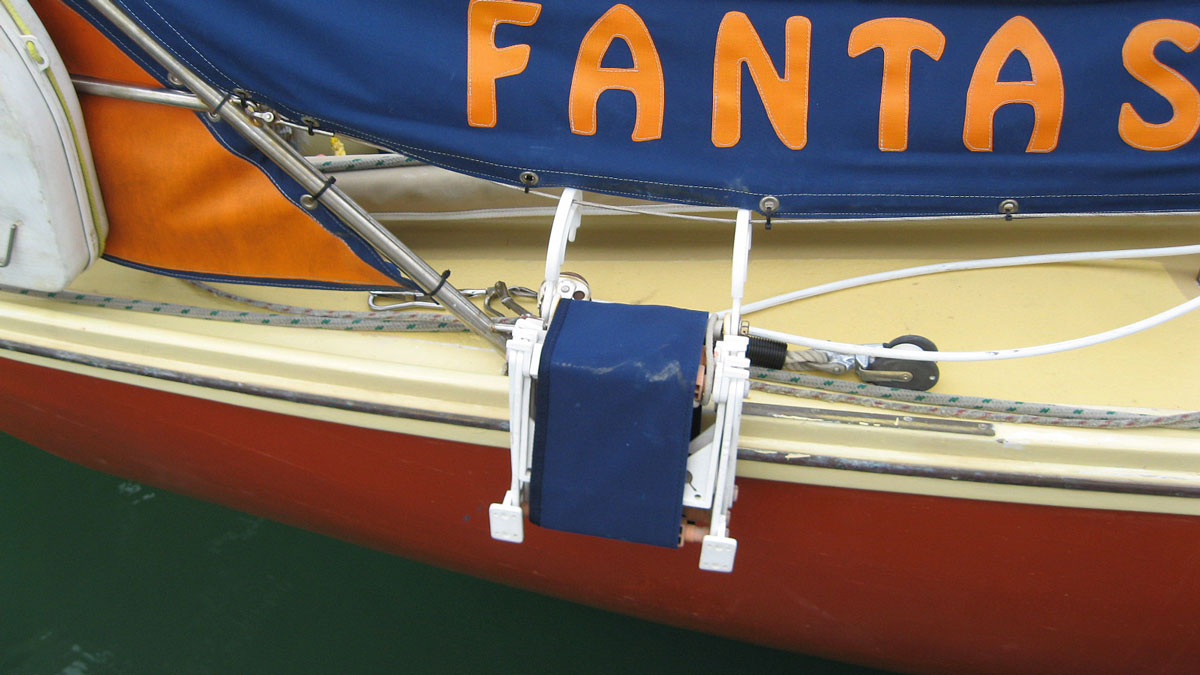
Singlehanded mooring aid
Single-handed sailing requires forethought and a little extra preparation – no more so than when coming alongside. I had this…
Want to read more adventurous stories about from a solo sailor?

A subscription to Practical Boat Owner magazine costs around 40% less than the cover price.
Print and digital editions are available through Magazines Direct – where you can also find the latest deals.
PBO is packed with information to help you get the most from boat ownership – whether sail or power.
-
-
-
- Take your DIY skills to the next level with trusted advice on boat maintenance and repairs
- Impartial, in-depth gear reviews
- Practical cruising tips for making the most of your time afloat
-
-
Follow us on Facebook, Instagram, TikTok and Twitter