
On tidal estuaries boat owners can become explorers. Ken Endean has advice for potential creek crawlers

Tidal estuaries can be fascinating places, even for passage-hardened offshore sailors.
They offer all the intricacies of tidal navigation, often combined with delicious rural scenery and frozen-in-time riverside settlements, where quays and hard landings were once used by sailing barges.
Some accommodate substantial ports, where visiting leisure sailors benefit from clear buoyage and pilotage aids, but must be alert to ship movements.
Others, including the upstream reaches of port estuaries, are essentially primitive inlets where boat skippers must act as their own pilots, using whatever information is available.
Every estuary is different, but there are likely to be narrow channels, shallow water and various obstacles.
In this article, I’m going to give more attention to the ‘primitive’ places, for which pilotage guidance and accurate information may be sparse.
Preparation before sailing tidal estuaries
Before deciding to visit an unfamiliar estuary, it’s essential to collect and study all relevant information, such as tidal data, charts, overhead cable clearances, etc.
I recently found that a high-level bridge (over the River Taw, at Barnstaple) did not have its headroom shown on charts.
After a phone call, the Hydrographic Office did their research and came up with a figure, but it took them a couple of days, and I’m glad I raised the query well before entering the river.

Study tidal data and charts before entering an unfamiliar estuary
At port estuaries, pay close attention to local regulations, such as the marine traffic routing in the approaches to Harwich and The Humber.
Some harbour authorities specify moving prohibited zones around large vessels and military units, and for heaven’s sake, if you pass a naval base, don’t get too close to any aircraft carriers or nuclear subs.
For places where anchoring would be difficult, it might be possible to borrow a mooring but this, like the bridge query, could take some time.
We visited King’s Lynn before it acquired its visitor pontoon; the River Conservancy refused us permission to anchor, and the dock company quoted an eye-watering sum for entering the gated basin, but the ferry operator had one of his boats away for servicing and was happy to lend us its mooring.
For the relatively undeveloped waterways, charts may be incomplete or out of date.
Sea bed survey dates are usually shown on charts in small block diagrams and may reveal that the upstream zones have not been checked for several years, or even decades.

Some tidal estuaries can dry at low tide, while others, like the Tyne are navigable their full length, regardless of tide state. Credit: mauritius images GmbH/Alamy
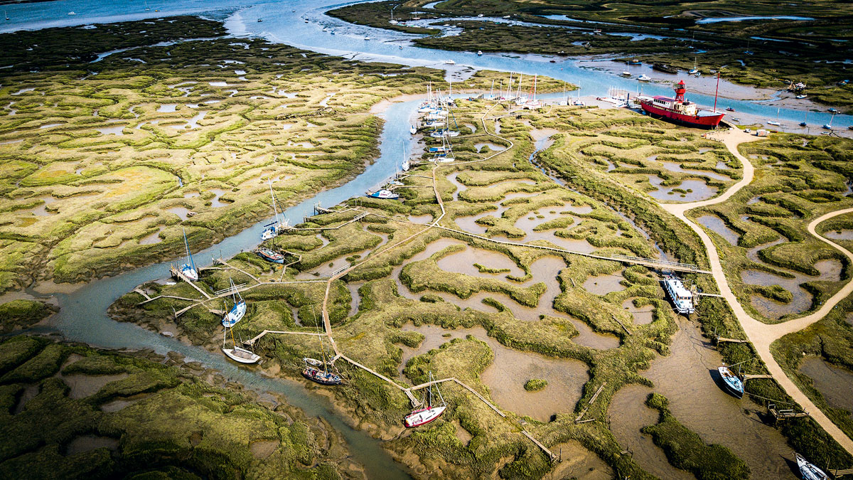
Inside the entrance to Cardigan’s River Teify, the channels writhe around within a wide, sand-filled basin, changing every year, and advice that mariners should obtain the latest large-scale charts is useless because the latest charts will be out of date as soon as they are published.
Therefore, visitors must try to obtain other sources of information, which might include aerial photographs and maps.
They will be equally out of date, but comparing several documents and images will sometimes reveal that parts of the channel regularly alternate between two temporary alignments, which improves the chances of finding the right line.
In general, where an estuary has a winding shape, with distinct meanders, the deep channel is likely to follow the outside of the bends, but where there is a wide, straight stretch there may be ‘braided’ channels where two or more weave across the full width, sometimes criss-crossing because one is shaped by the flood stream and the other by the ebb.
Many ‘undeveloped’ rivers were once busy with industries such as mining, brickworks and lime burning, served by small coasters that used navigation aids such as beacons and withies.
On the River Taw, downstream of Barnstaple, the charts still show those items, but some of them have not survived.
We supplemented our knowledge with an on-shore reconnaissance along the riverbank path, taking digital photos of the channel at low tide.
Another technique, as far as there is a clear view up the river and sufficient rise of tide, is to note when all the banks are just covered, then wait until the water level has risen enough for the boat to pass over them.
Depths and tidal heights
Some tidal estuaries, particularly those that have been deepened by dredging, such as the Tyne, have navigable depths at all tides for their full length, or at least to the first low bridge, but others are ‘dry’ at low tide – perhaps for part of their length.
Anyone navigating along them needs to know the bed levels and the height of tide, but with both those variables there is scope for confusion.
A chart may present channel bed levels in two ways.

If exploring further inland, be aware there could be inconsistencies in data as sections, like Cotehele on the Tamar River, have not had a modern survey. Credit: Ken Endean
The usual convention, which is described in most instructional publications, is to show both depths and drying heights in relation to the chart datum at the mouth.
The alternative method is by stepping up the chart datum to follow the rising bed.
Some charts even use both: for instance, charts for the Tamar estuary show the main river’s bed levels against a stepped datum, whereas on its large River Lynher tributary, everything is related to the coastal chart datum at the estuary’s mouth.
On some tidal estuaries, such as the Dart and the Fowey River, there are several datum steps, and the cartographers may show them on a diagram as a longitudinal section along the channel.
At Fowey, MHWS is 5.4m above chart datum. At high tide, the water surface along the estuary is more-or-less horizontal, but at Lostwithiel, the tidal limit, the bed level and chart datum are higher by 3.9m, leaving a navigable depth of only 1.5m (see diagram below.

Diagram to show changes in Chart Datum in the River Fowey. Credit: Leisure chart folio
In an almanac, similar data is revealed in the data blocks of tidal height differences.
However, on some tidal estuaries, this data is incomplete.
At the mouth of the Tamar River, MHWS is 5.5m. At the inland Cotehele Quay, MHWS difference is given as minus 0.9m, indicating that chart datum is raised by 0.9m, but there is no information for places further inland.
In fact, there are several more steps in the chart datum and at Weir Head, the tidal limit, the datum is actually raised by about 3.5m, leaving a depth of about 2.0m for navigation.
The reason for inconsistencies is probably that these upstream reaches were originally surveyed with simple equipment (rowing boats and lead lines?) and the Admiralty has never got around to doing a fully detailed modern survey, possibly because nobody envisages taking a frigate up to Cotehele or beyond.
My Tamar bed profile (below) was deduced by making a transit along the river at high tide, recording the depths by echo sounder and then deducting those depths from the predicted height of tide.

Credit: Ken Endean
The Hydrographic Office later commented that it was ‘probably about right’.
Anyone heading inland on a river where upstream reaches dry must bear in mind that the figures on a chart may only give part of the picture. On a first visit, it’s sensible to proceed slowly and with the echo sounder working.
Tidal streams
Estuary tidal flows might be simple – in with the flood and out with the ebb – but on long, shallow rivers, the flood behaves as a low wave that is slowed by the restricted depths.
At places upstream, the time of high water will be later than at the mouth and also the ebb flow may not start until some time after that delayed high water.
For instance, at Nantes, the limit of mast-up navigation on the river Loire, MHWS is 0135 later than at the mouth, and the start of the ebb stream is at least half an hour later again.
This is fine when travelling upriver, because the flood stream will be favourable for about 8 hours, but a boat returning to the sea will have only 4 hours of helpful ebb before meeting the next flood on the downstream reaches.
Making an entry
At some tidal estuaries, the mouth is the first obstacle, especially if the channel is poorly marked, and exposed to swell, such as at Hayle.
At a buoyed entrance, the channel can move, especially when the banks are sand: at both Aberdovey and Blakeney, we have found starboard hand buoys sitting on top of the sand banks, only a month or so after they were resurveyed and repositioned.

When exploring tidal estuaries, check depths to ensure your boat can take the ground level. Credit: Ken Endean
Where a river’s current has a scouring effect within a narrow estuary, as at Wisbech and King’s Lynn, it can drop a bank of silt or sand where it meets open water and loses speed.
Harbour authorities may publish recent depth surveys on their website, or offer advice by phone or VHF radio, but each incoming skipper must make their own judgement about the best strategy for entry.

In some channels exposed to swell, buoys can move; check with the local harbour authority before entering the channel. Credit: Tony Peacock/Alamy
I once prepared a careful pilotage plan for a particularly tricky river mouth, only to be persuaded by the harbourmaster that we should follow a different line and he should ‘talk us in’ by mobile phone.
That went splendidly until he dropped his phone in the sea.
When the time comes for departure, consider leaving against the late flood rather than waiting until after high tide, because the ebb current could kick up a rough sea state when it fights against incoming waves.
At places like Bideford Bar, which is exposed to Atlantic swell, a late departure could definitely be hazardous.
Boat handling on tidal estuaries
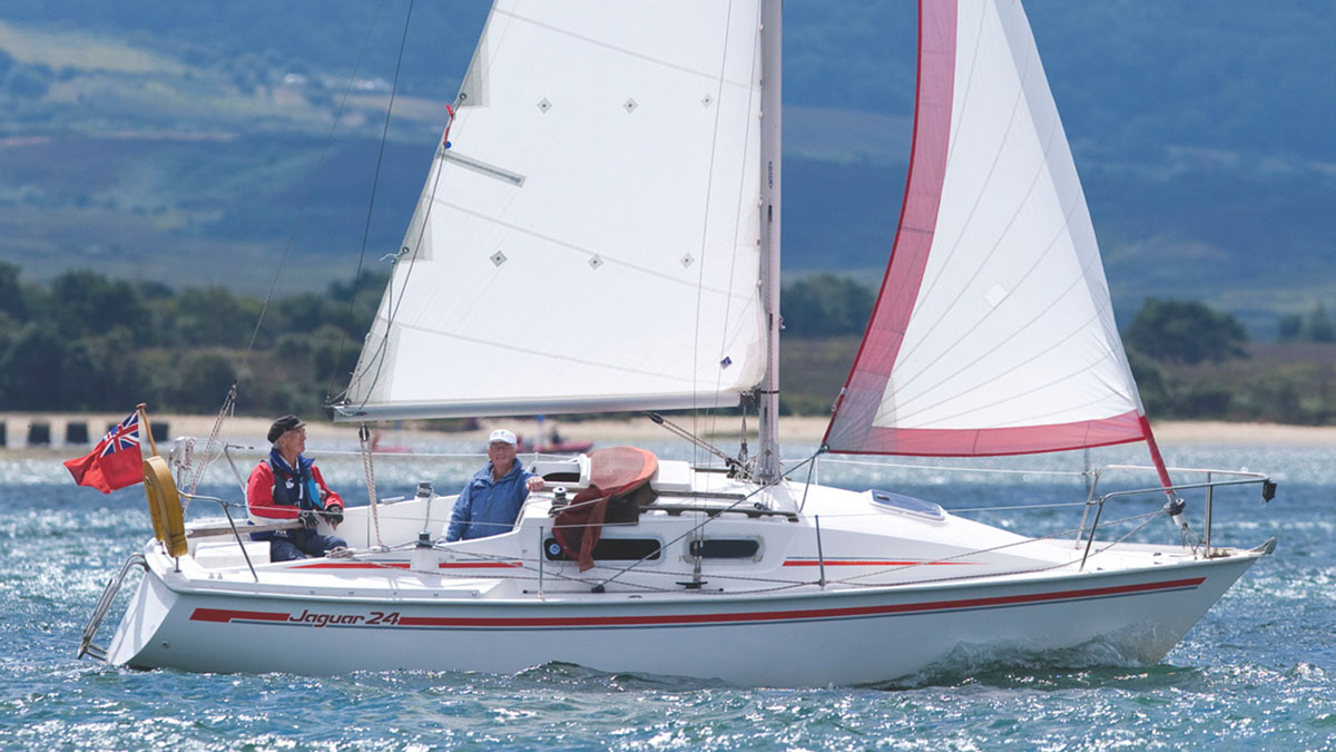
On most tidal estuaries, a modern yacht’s crew should be able to emulate the old coasters by proceeding under sail, but special care is required where modern moorings occupy much of the navigable water, especially if the wind turns fluky in the lee of hills.
Going with the tidal stream is good for progress, but take care not to be set on to a moored boat by the current.
Mooring and anchoring
If a boat must remain afloat at low tide, the choice of stopping place should be checked by echo sounder reading and height-of-tide calculation.
Where there is a large tidal range, low water at neaps may be well above chart datum, allowing enough depth for a boat to lie afloat even where the chart shows drying foreshore.
On drying tidal estuaries, the currents are likely to scour some deeper ‘holes’, generally on bends.
On the Tamar bed profile, these ‘holes’ are shown where the bed dips below the chart datum line.

You should be able to sail most estuaries, but beware of moored yachts. Credit: Richard Langdon
When intending to take the ground, it’s advisable to check depths around the anchoring spot, so that the boat does not settle on a steep slope.
Also, look out for debris such as waterlogged tree trunks – quite common in rural estuaries – and for lumps of rubble when mooring alongside old quays.
In the old days, they would have been cleared before the next coaster was due, but coasters no longer come.
When lying aground, downstream of a single anchor and lifting off on the next flood, it’s possible for a cruiser to drift gently forward over her ground tackle, so that the chain becomes wrapped around keels and rudder – or beaching legs.
This can be prevented by anchoring fore-and-aft and the stern anchor can be brought in as soon as depth has increased.
For taking the ground upstream of moored local boats, it’s important to allow them plenty of swinging room because they’ll be lying downstream of their sinkers, but if they are of shallow draught, they may re-float before the cruiser and then swing upstream while she is still aground.
Similarly, it’s prudent to lift the tender on board, otherwise the early flood might float it in under the hull.
Upstream objectives
Why head upstream? It might be to reach an old port town at the tidal limit, such as Pontrieux or Kingsbridge, at both of which a boat must arrive and moor before the ebb empties the channel.

Do not rule out heading upstream, otherwise you might miss such delights as Orford on the River Ore. Credit: Richard Langdon
Or perhaps we want a tranquil anchorage in wooded surroundings, like Maggotty Bank on the Truro River. Or the compromise of a village like Orford on the River Ore (deep water) or Golant on the Fowey River (drying).
Both have pubs and small shops, so there is no need to hurry away again.
To the limit?
Crews who fancy themselves as explorers may decide to use their tender while leaving their cruiser in a secure anchorage.
On the River Lynher, the Notter Bridge Inn is at the tidal limit, but trees close over the river for the last mile, so a low-headroom boat is essential when hoping for a pie and a pint.
When we were in the Solway Firth, at the mouth of the Water of Urr, the river channel was unmarked and I suspected mid-stream banks, so we left our Sabre 27 London Apprentice lying off Kippford, launched our tender, and rowed gently up the narrow, winding river to the delightful village of Palnackie.
Landing at the old barge dock, we were entertained by an elderly gent with tales of local quarrymen who tried to dredge the dock with gelignite, with very muddy results.
Going ashore
If planning to moor against an old quay, check that there are suitable ladders, as the originals may have rotted or rusted away.

Make sure ladders are in good condition if you plan to moor alongside. Credit: Panther Media GmbH/Alamy
On many tidal estuaries, particularly in their upper reaches, the drying banks are of thick mud and for going ashore by tender, there needs to be a suitably firm landing place.
Any pontoons, slipways or rubble hards may not extend to low water, but on some rivers, there are rock outcrops or gravel beaches where currents and waves have washed away the silt, such as at the appropriately named Stone on the River Blackwater and Stone Point in the Walton Backwaters.
Taking shelter
Strong winds are a good reason for finding a sheltered inland anchorage, and the best protection is usually found in the lee of wooded shores, where the trees help to damp down the gusts, such as at White Rock on the River Dart.

The lee of wooded shores can offer good protection in strong winds. Credit: Nic Compton
If anchoring in flat, open county, as on the River Alde, choose a reach where the wind is blowing across the channel, so the boat lies quietly on both flood and ebb with the wind abeam.
Where wind blows along a reach, it will be against the current for half the time, and the boat will be inclined to yaw around her anchor.
For the future
When you have visited and explored an estuary, especially if it’s of the undeveloped kind, you’ll probably possess data that is valuable for future visits, such as depths and handy navigation marks not shown in any publication.
Keep notes for future reference, and if you’ve found important errors on charts, please pass that information to the Hydrographic Office.
Seamanship tips from a seasoned sailing instructor
Sticky Stapylton has sailed thousands of miles and taught numerous people how to sail. He shares some of his seamanship…

How to sleep sailing shorthanded
John Apps stresses the importance of sleeping sufficiently on long-distance single-handed passages, and explains how to snatch safe naps without…
Understanding tidal streams and heights
Understanding tidal streams and heights is essential for passage planning and safe navigation. The RYA's former chief examiner, James Stevens,…
Basic survival celestial navigation
Making a ‘mer pass’ observation is one of the simplest, yet most useful navigation tools for sailors to possess, explains…
Want to read more articles like this?

A subscription to Practical Boat Owner magazine costs around 40% less than the cover price.
Print and digital editions are available through Magazines Direct – where you can also find the latest deals.
PBO is packed with information to help you get the most from boat ownership – whether sail or power.
-
-
-
- Take your DIY skills to the next level with trusted advice on boat maintenance and repairs
- Impartial, in-depth gear reviews
- Practical cruising tips for making the most of your time afloat
-
-
Follow us on Facebook, Instagram, TikTok and Twitter